
Find Your Memphis Neighbors
Block research begins with a location and a narrow question. The public sources below can show parcel relationships, recorded owner information, historical address clues, civic geography, or official service activity. They do not supply a definitive list of everyone who may be present at a home. An owner may use another correspondence address, a past directory listing is dated, and an election-related record has separate access rules. Keep each finding with its custodian and date.
| Source | What It Shows About a Block | Access |
|---|---|---|
| Register GIS | Property address, parcel ID, tax map, owner field, surrounding parcels, and historic-aerial links | Official online viewer |
| ParcelOwnDetails | Owner-name slots and address number, direction, street, suffix, unit, city, state, ZIP, ZIP+4, and notes fields | Official county query layer with pagination and distance queries |
| Memphis GIS | Neighborhood, ZIP, council, boundary, park, landmark, floodplain, and transportation context | Official city map service |
| Shelby Election Commission | Official voter-list request options, subject to citizenship, timing, and political-purpose limits | Commission request channel, not a casual block list |
| Register Archives and library sources | Dated directory, map, census, and local-history leads for the block | Online index, archive, or library access varies by series |
For Memphis neighbors, distinguish a parcel owner from a person who may have been listed at the address in another source. The safe result is a dated, source-labeled block note. It should say what the parcel or record establishes and what remains unconfirmed.
Map a Memphis Neighbor Block
Shelby Register GIS is the practical first stop for a compact block because its detail page links a property address to a parcel, tax map, owner field, appraisal, lot, subdivision, plat reference, acreage, tax district, and nearby parcels. Use it to identify the shapes immediately touching or surrounding the starting parcel. The map is a spatial guide. A later Register search is necessary when a transaction may be newer than the roll reflected in GIS.
- Find the starting address in Register GIS and save the property address, parcel ID, tax map, and source date.
- Select the parcels that meet the block question, keeping each parcel ID and owner field in a separate row or note.
- Check the parcel and owner details against the Register’s real-estate index when a dated instrument is needed.
- Add a neighborhood or boundary layer only to describe local context, not to identify private occupants.
- Use the Memphis street directory when the task expands from the immediate block to a full street-by-street record trail.
This flow prevents an easy mistake: treating the map label as current legal ownership or treating an owner field as proof that someone is at the location. The Register GIS data reflects the April 2019 certified tax roll and is not a survey or guarantee of current legal boundaries.
Note: Save the parcel ID before comparing a deed, because street-number changes and parcel splits can otherwise obscure the match.
Read Memphis Neighbor Parcel Fields
The county’s public ParcelOwnDetails table is designed for structured parcel information. It exposes owner-name slots and detailed address components, including unit and ZIP fields, while the Assessor Parcel layer supplies map and a 15-character parcel ID. These services support query, statistics, pagination, and distance queries. A distance query can help identify nearby parcels, but it is still a technical result that needs comparison with the human-facing property record and a current instrument when dates matter.
The Shelby County ParcelOwnDetails layer displays the owner and address fields available for a block-level review.
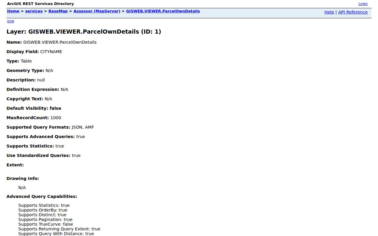
The table is best used as an index to the next official source. It can locate a parcel by its components or nearby geometry, but a field can be incomplete or stale. Record the output as a parcel lead, then confirm an important transfer in the Register index or through the custodian.
Map Memphis Neighbor Context
A parcel map does not describe the civic setting around a block. Memphis GIS offers neighborhood, ZIP, council district, city and municipality boundary, census block group, parks, landmarks, hydrology or floodplain, and transportation layers. Use them to tell whether a location falls within a named neighborhood or near a civic feature. ZIP is postal geography, not a municipal boundary, so a ZIP label should never stand in for the city boundary or parcel tax-district field.
The layer choice should match the question. A neighborhood layer can establish geographic context. A council layer can establish a public district. A city-boundary layer can test a municipal claim. None identifies Memphis neighbors. These distinctions keep a block note clear and prevent a map result from becoming a personal profile.
Memphis Neighbor Civic Leads
Community material adds context only when its status is clear. The City’s neighborhood-associations landing page did not expose a complete member directory during research. The named organizations below come from public planning or stakeholder material. They are leads for local history or civic geography, not verified membership lists, boundaries, meeting calendars, or contact rosters. Confirm a boundary with the Memphis GIS Neighborhoods layer before describing a block as part of any area.
| Named Memphis civic lead | Context supported by the research |
|---|---|
| Central Gardens; Evergreen | Midtown block and preservation context |
| Binghampton Development; Green Meadows-Poplar Glen | East and Midtown community-organization context |
| Cooper-Young; Victorian Village | Commercial-corridor and neighborhood-history context |
| Lemoyne-Owen; Orange Mound CDC | South Memphis and African American community context |
| Soulsville; Tucker-Jefferson; Uptown Alliance | Heritage, civic, North Memphis, and riverfront context |
The City Office of Community Affairs describes liaison work with neighborhood associations, faith groups, civic groups, and human-service organizations. Its NExT program supports multi-generational and multicultural neighborhood associations. That is a useful handoff for civic context, but it does not turn an unverified name into a block roster.
Note: Treat a planning-report organization name as a research lead, then confirm current boundaries and contacts with the organization or City source.
Memphis Neighbors and Voter Access
Tennessee’s online voter lookup requires county, first name, last name, birth month, and birth year. It is not an address-only block search. A no-match notice directs the user to verify the information and contact the local election commission. A result should be treated as a current-registration lead, not evidence that a person was at a particular address on a particular date.
Shelby Election Commission instructions add important limits. Requests must come from Tennessee citizens, voter lists are for political purposes, and inspection is generally unavailable during the 30 days before an election until certification. The office does not perform research or analysis. Its current form offers a name-and-address-only XLSX product, a fuller XLSX or CSV product, a daily early-voting email option, wall maps, and custom requests. Follow the current form, signature, and certification requirements rather than trying to construct a block list from partial results.
Memphis Neighbor Service Context
Memphis 311 provides an official city route for service and issue reports. Anonymous submission is available, although account registration can improve tracking. A request number or address can be a lead to a city process, not a way to identify private neighbors. Develop 901 can add planning, permit, construction, inspection, fire-permit, sign, and project-location context, while Code Enforcement can provide process leads that may be limited or incomplete.
The Memphis 311 service portal shows the city channel used to submit and follow an issue.
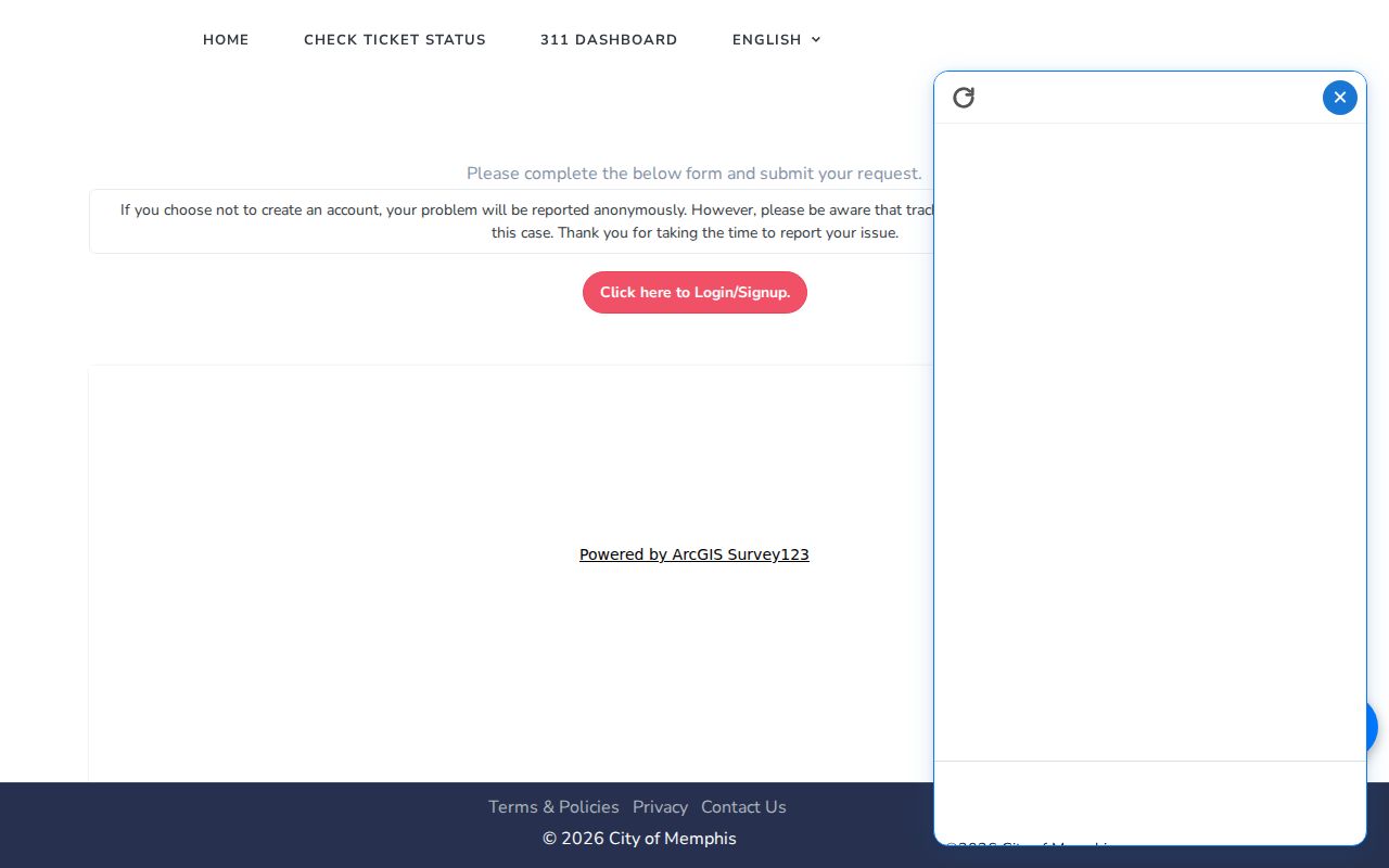
Read a service record narrowly. It can document a request or a status, but it should not be treated as proof of an allegation or as a statement about a particular person. Preserve the source, request number if available, date, and current status.
Compare Memphis Neighbor Sources
Official records and commercial neighbor-search categories answer different questions. The stronger path for a block inquiry is to begin with the official source that maintains the field, then note its date and limitation. Commercial tools can be convenient indexes, but their source date, update method, and match logic may not be clear. Neither category should be used to make a claim about a person without a dated record and independent corroboration.
| Official record route | Commercial neighbor-search category |
|---|---|
| Names the custodian, record type, and available field or image | May combine sources without showing the original record clearly |
| Can be checked against an instrument number, parcel ID, or city request number | May lack a stable identifier for verification |
| Shows the date and limits of the specific source | May not make update dates or coverage limits clear |
A compact research log is more useful than a long list of names. Keep the address searched, source mode, date, parcel or record identifier, evidence state, corroboration, privacy action, and next custodian handoff.
Memphis Neighbors and Block Watch
For a civic safety concern, MPD Neighborhood Watch offers a defined community route. The process is to call a local precinct coordinator, hold two meetings, and request signs. The general Neighborhood Watch contact is 170 North Main, with 901-545-2677 and 901-636-3700 listed for coordination. This route is for community organization and safety planning, not for informal person searches.
Use civic routes to learn how a block organizes itself or to connect with official public-safety resources. Keep private addresses and sensitive details out of a shared block note. When historic context is needed, library maps, directories, and aerials can explain how the block changed over time without naming current people.
Note: A Neighborhood Watch contact can coordinate civic activity, but it does not confirm a person’s address or membership in a local group.
Memphis Neighbor Privacy Boundaries
Public access does not remove privacy obligations. Do not publish SSNs, driver-license numbers, full birth dates, financial information, medical details, unredacted minor information, causes of death, or exact addresses for protected people. Tennessee’s Safe at Home program gives eligible participants a substitute address. A protected-address signal should end the search for publication and be referred to the appropriate custodian or legal review.
Keep the block question narrow. Tennessee’s public-record framework, sealed court rules, vital-record entitlement, election restrictions, and other exceptions all limit particular records. A person with a similar name, an owner field, or an old directory entry is not enough to make a present-tense identification.
Lawful use. Use Memphis neighbor records for personal, lawful research and civic context. Do not use block information to watch, harass, intimidate, or harm anyone; Tennessee law prohibits stalking and harassment.