
Trace a Memphis Street by Address
Begin with the address as printed, not a surname alone. In Memphis, the most useful path is address to parcel or tax map, then owner field, recorded instrument, voter-access check where permitted, and a dated directory or map for historical context. Each stop answers a different question. The parcel can connect a location to a tax-map identity. A deed can identify parties to a transfer. A directory can supply a dated address clue. None of those records, by itself, proves that a particular person currently occupies the property.
- Enter the street number and street name in Shelby Register GIS, then retain the property address, parcel ID, tax map, and date checked.
- Open nearby parcels on the map to see the block pattern, but keep the owner field separate from any conclusion about present occupancy.
- Search the address or parcel in the Shelby Register real-estate index and record the instrument number, date, document type, and indexed parties.
- Use the Shelby Election Commission’s rules before seeking any voter-list product. Its requests are restricted to Tennessee citizens and political purposes.
- For an earlier period, compare a reverse address listing, historic map, or city-directory entry and mark the result as a dated lead rather than a current match.
A complete street directory trail preserves the source date and any conflict. A later recording can outrank a stale owner field, while an old directory may describe a business or household at the address rather than a legal owner.
Memphis Street Directory Record Sources
Address-keyed sources in Memphis overlap, but they do not have the same purpose. The Register keeps permanent real-estate instruments. Register GIS provides a spatial starting point. County layers expose structured parcel and owner-address components. City systems add project and service context. Use the source that matches the fact being checked, then save the record identifier before moving on.
| Address-keyed source | Custodian | Street evidence | Access route |
|---|---|---|---|
| Register GIS | Shelby Register | Property address, owner, parcel ID, tax map, plat reference, and nearby parcels | Official online viewer |
| Parcel Information and ParcelOwnDetails | Shelby County GIS | Address components, geometry, owner slots, unit, ZIP, and notes fields | Official query layers; check against the human-facing record |
| Real-estate index | Register of Deeds and Archives | Address, parcel, instrument, book/page, date, and indexed transfer parties | Basic online index, then image or office copy |
| Develop 901 | City of Memphis | Planning, zoning, permit, inspection, fire-permit, sign, and project-location leads | Online portal; some workflows may require an account |
| 311 and Code Enforcement | City of Memphis | Issue, complaint, or enforcement trail by address or request number | City channel; some records can be restricted or incomplete |
Parcel IDs are useful joins, not proof on their own. Carry the address form, parcel ID, instrument number, source date, and evidence status together. That makes it easier to spot a parcel split, a combined tract, or a new deed that changed the chain.
Note: A zero result means no hit in the searched index and date range, not that no record exists.
Search Fields for Memphis Streets
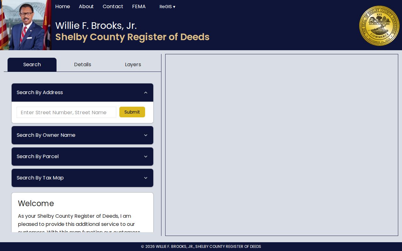
The Register GIS search offers several practical ways into a Memphis street directory search. Entering an address can be faster when the number is known, while the owner and parcel choices help when an earlier document supplied only part of the location. Once a detail page opens, copy stable identifiers before relying on the map display. The related county parcel services support nearby and distance queries, but their structured output still needs a current-record check.
| Visible Register GIS field | Input | Use for a street search |
|---|---|---|
| Enter Street Number | Number | Pairs with the street name to find one property address |
| Street Name | Text | Finds the address form used by the GIS record |
| Owner Name | FirstName LastName | Tests a name against the parcel record |
| Parcel ID | Identifier | Direct pivot from a deed, map, or other county source |
| Tax Map ID | Identifier | Connects the street result to its map reference |
The Register GIS interface shows the address, owner, parcel, and tax-map inputs used for this first pass.
The result details can also show appraisal, tax district, year built, lot, subdivision, plat book and page, dimensions, acres, owner address, class, use, coordinates, recent records, and historic aerial links. Treat the owner address as correspondence information unless another dated source supports an occupancy conclusion.
Read Memphis Parcels Along a Street
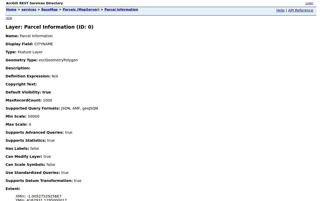
A parcel is the mapped unit used for property administration. On a block, it supplies the geometry that connects one address to the next, even where a street number has changed. The county’s Parcel Information layer includes address components and city name. Its Assessor Parcel layer supplies the map and a 15-character parcel ID. ParcelOwnDetails adds owner-name slots, street components, unit, city, state, ZIP, ZIP+4, and notes fields. Query, pagination, statistics, and distance options are available, but the results may be incomplete or stale.
Shelby County’s Parcel Information layer is the source behind this address and map-reference view.
Use neighboring shapes as a map check, then verify the selected property in the Register’s human-facing detail page. The GIS disclaimer matters: its map data reflects the April 2019 certified tax roll and is neither a survey nor a guarantee of current legal ownership boundaries.
Search Memphis Deeds by Street
The Register’s real-estate portal has Address Search, Parcel ID and Lot Number Search, Document Number Search, name modes, and instrument-type modes. Address Search accepts address, start and end dates, city, ZIP, subdivision, and up to three instrument-type selectors. City, ZIP, and subdivision do not appear on every document, so an empty field should not decide the search. Start broad, preserve the date window, and open the instrument through its number when a result is relevant.
The portal suggests omitting street direction and type for a first pass. Search MAIN before N MAIN ST, then try the full address, parcel ID, owner surname, and grantor or grantee separately. The grantor is the party conveying an interest, while the grantee is the party receiving it. Instrument-type searches return only the first 1,000 hits, so a long street result needs a narrower date range. An index entry is a lead, not the deed image.
Note: Keep the recording timestamp and document type with the instrument number so later research can distinguish a transfer from another filing.
Memphis Address Search Variants
Street form is a major source of missed records. A directional prefix can be absent in the index, a street type may be shortened, and an old address can appear under a prior spelling. Use the Register’s street-only advice first, then test the exact printed form. Record every variant that was searched. That simple log prevents a later researcher from mistaking an untested spelling for a true absence.
For a historical corner, search both frontages, the intersection, and a business name where the source supplies one. Memphis Library’s example links old 338 Main at Union with 77 South Main after the 1905 renumbering. The 1903 directory clue at 337 Main and the 1912 entry at 352 to 354 Poplar show why old numbers may carry a business or household lead rather than a modern parcel match.
Note: Label any link between an old number and a modern parcel as an inference until maps, directories, and the recorded chain agree.
Bridge Memphis Street Name Changes
Historical address work needs a map bridge. Memphis Library notes that Linden became Dr. Martin Luther King Jr. Avenue, and Binghampton was annexed in 1919. Those facts change how an old listing should be searched. A current municipal label should not be imposed on an earlier record. Compare street name, direction, number, time, nearby intersection, subdivision, block or lot, parcel, and former name before joining results.
Memphis Public Library’s history resources include a 1904 F. W. Faxon map and a 1925 map. Sanborn volumes from 1907 and later add footprints, entrances, use, and adjacent businesses. They are strong context for a street directory trail, but they do not name a current occupant. The local history material is most useful when the deed index and modern map seem to point at different places.
Memphis Address Permits and Code
Memphis Develop 901 adds property activity that is not part of the deed chain. The city describes the service as covering planning, zoning, construction, signs, fire permits, licenses, current and previous activity, and inspections. Search by address, owner, or parcel where the portal permits it, and preserve project or application numbers. Some workflows require an account, and an office or records request can be the better fallback when the online route does not expose the needed document.
The Memphis building and zoning portal is shown here as an address-based starting point for permit and inspection context.

Code Enforcement and Memphis 311 can supply issue or enforcement leads by address or request number. Complaint and enforcement material may be incomplete or restricted. A code record should be read as a process record, not as a claim about a person.
Note: The city’s code process can involve a title search and notice by certified mail, so retain the actual record status and date.
Memphis Street Directory Terms
Four terms recur in address work. Using them precisely keeps a street result from becoming a broader claim than the record supports.
- Parcel
- A mapped property unit used by county property systems and identified by a parcel ID.
- Situs address
- The location of the property itself, distinct from an owner’s correspondence address.
- Plat
- A recorded map that can describe lots, subdivisions, and the layout associated with a tract.
- Criss-cross directory
- An address-arranged directory used to place dated household or business entries along a street.
These terms help keep the street directory chain honest. A plat or parcel places land; a dated directory may place a listed household or business; a recorded instrument identifies parties to a filing.
Memphis Street History Evidence
The Memphis city-directory collections hold the historical shelf for a street search. The Register’s directory mode names Memphis City Directories 1849 to 1943, although some volumes are partial. Its controls include City Directory, Section, and Alpha selections. Save the selected title, year, section, page, spelling, category, and nearby entries. That makes an address lead reviewable when a number was later renumbered or a block was altered.
Memphis Public Library adds directories, telephone books, yearbooks, maps, clippings, local books, oral histories, newspapers, and more than 20,000 genealogy books through its History and Social Science Department. Dig Memphis is searchable by subject, period, item type, and keyword. Together they can help place a street clue in time without substituting a library listing for an official land record.
Check Memphis Address Evidence
Use a confidence label at the end of the chain. A high-confidence link has an agreeing parcel and instrument, an inspected image, dates that fit, and a second independent source. A medium link has an index and GIS agreement but no verified image or unresolved renumbering. A low link rests on one surname, one directory entry, or an owner field without a matching date.
If an assessor owner field conflicts with a recent deed, retain both dates and ask the Register or Assessor which record is current. For a record not available online, the Register and Archives provide office and copy channels. A narrow request naming the address, instrument, date range, or series is more workable than an open-ended request.
Note: Record whether the evidence is an index hit, inspected image, or certified copy request before reporting any conclusion.
Memphis Street Privacy Boundaries
Public access has limits. Do not publish sensitive identifiers, full birth dates, financial details, medical information, unredacted minor material, or a protected address. Tennessee’s Safe at Home program gives eligible participants a substitute address, and a protected-address signal should stop publication and be referred to the custodian. Court, vital, and election rules may also limit a record even when a related address appears elsewhere.
Lawful use. Use Memphis street records for personal, lawful research and civic understanding. Do not use an address chain to watch, harass, intimidate, or harm anyone; Tennessee law prohibits stalking and harassment.